![]()
300 m annual global land cover time series from 1992 to 2015
Submitted by abellavia on Mon, 2017-04-10 14:35


CCI Land cover - 300 m annual global land cover time series from 1992 to 2015 - available now for download
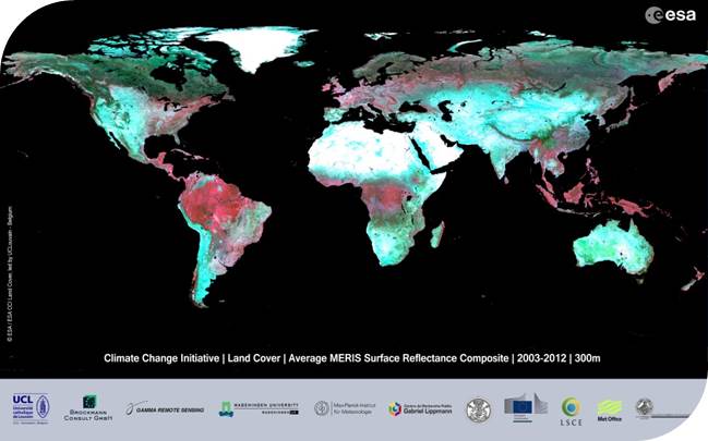
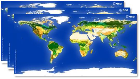
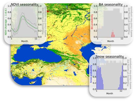
In the framework of the Climate Change Initiative (CCI) of the European Space Agency, the CCI Land Cover partnership is pleased to announce the official release of the CCI 300 m annual global land cover time series from 1992 to 2015. This unique dataset was produced thanks to the reprocessing and the interpretation of 5 different satellite missions. The attached newsletter introduces the 24 global land cover maps and a set of additional products associated to them. All these products can be visualized interactively (click right to get the surface seasonality for any pixel on Earth) and downloaded using the CCI Land Cover viewer at http://maps.elie.ucl.ac.be/CCI/viewer/.
Would you be unable to visualize the new version of the maps on the viewer, please try clearing your brower's cache and cookies.
All products are delivered along with an aggregation tool, enabling their re-projection and re-sampling as well as the translation from LC classes into Plant Functional Types for the different climate models.
Would you have any specific question not addressed in the updated Product Users Guide regarding this release, please contact us at contact@esa-landcover-cci.org. While this product is unique, we do recognize some shortcomings related to the availability of satellite data in particular for the very first years.
Click here below :
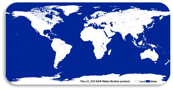
CCI Land Cover products