![]()
Land_Cover_cci : Recent progresses and status.
Submitted by Anonymous on Wed, 2012-08-01 07:25


In this section we report on the current status and recent progress realized in the framework of the Land_Cover_cci project.
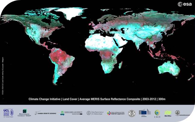
After complete acquisition of SPOT VGT, MERIS RR and MERIS FR surface reflectance data as well as Wide swath ASAR data, the 2008-2012 MERIS FR and RR 7-day composites were pre-processed by Brockmann Consult and provided to UCL.
The 7-day composites are now going through the UCL classification chain, which should yield the first project land cover epoch (2008-2012) near mid September 2012. This data set will be made available to the climate modelers involved in this project for internal validation through a data aggregation and delivery tool specifically developed for this project.
Due to encouraging results shown during the round robin exercise, ESA has agreed to include in the project an additional activity consisting of the development of an urban area mask based on SAR data. This activity will start during at end of Q4 2012 and will be covered by UJena and Gamma Remote Sensing.
With regards to deliverables, the DPMv1, IODDv1, ATBDv1 and PVASRv1 are being finalized and will be soon (coming weeks) available on the Land_Cover_cci website.
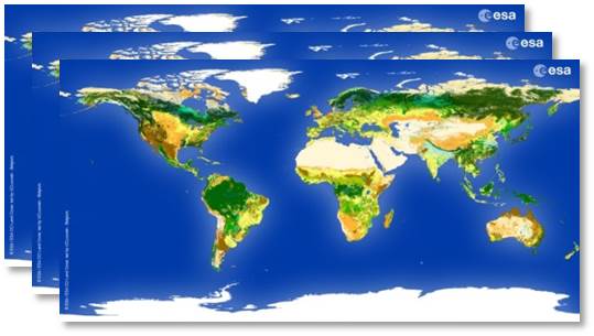
CCI Land Cover products