![]()
Land cover maps
Submitted by Anonymous on Wed, 2014-10-01 15:58


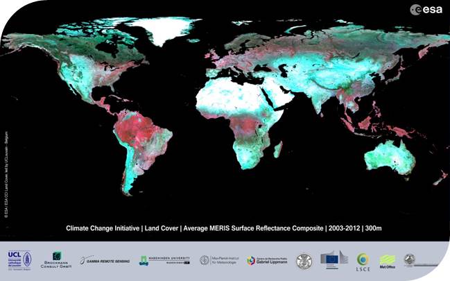
Three global LC maps for the 2000, 2005 and 2010 epochs
The CCI-LC team has successfully produced and released its 3-epoch series of global land cover maps at 300m spatial resolution, where each epoch covers a 5-year period (2008-2012, 2003-2007, 1998-2002). These maps were produced using a multi-year and multi-sensor strategy in order to make use of all suitable data and maximize product consistency. The entire 2003-2012 MERIS Full and Reduced Resolution (FR and RR) archive was used as input to generate a 10-year 2003-2012 global land cover map. This 10-year product has then served as a baseline to derive the 2010, 2005 and 2000 maps using back- and up-dating techniques with MERIS and SPOT-Vegetation time series specific to each epoch.
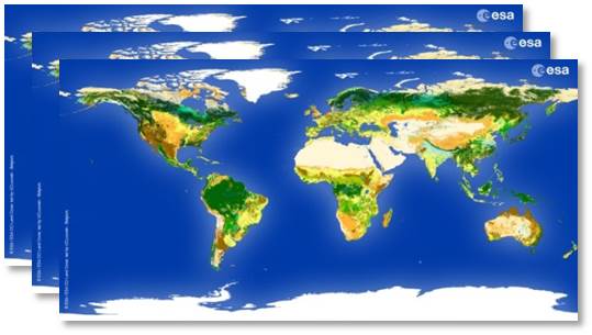
In order to meet the user requirement set in this project, the map proposes a legend based on the UN Land Cover Classification System (LCCS) with the view to be as much as possible compatible with the GLC2000, GlobCover 2005 and 2009 products. The level of thematic details was found to be improved with respect to previous global LC products. Each map is characterized by a set of quality flags.
For more information on the products, go to: http://maps.elie.ucl.ac.be/CCI/viewer.
For any further questions or concerns, please contact us at contact@esa-landcover-cci.org.
CCI Land Cover products