![]()
Successful development and internal release of three global land cover maps with 300m resolution
Submitted by Anonymous on Tue, 2013-05-28 15:04


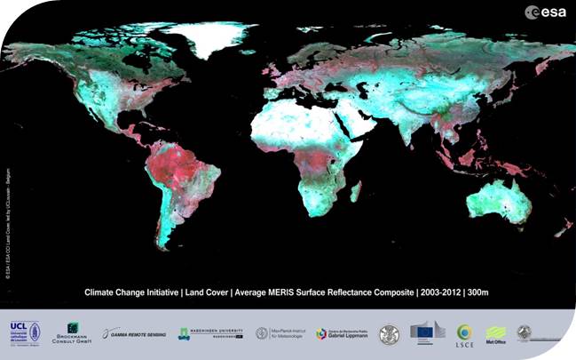
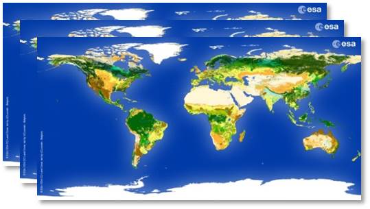
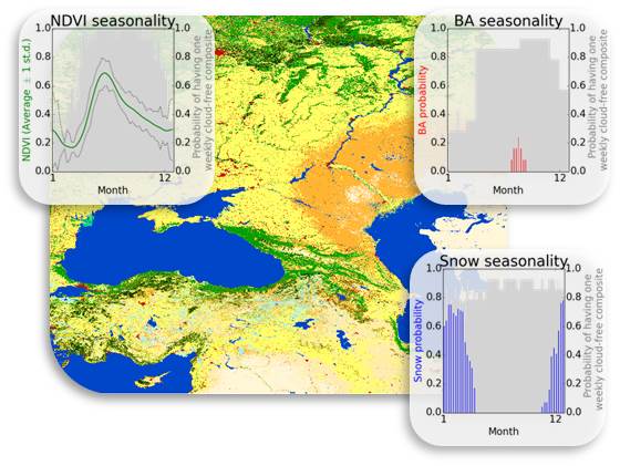
The CCI Land Cover (LC) team is proud to announce the successful development of three new global land cover databases at 300m resolution, which consist of LC state products for three epochs – centred around 2000, 2005 and 2010 – and of LC condition (snow, NDVI and burnt areas) products. The global surface reflectance (SR) composite time series for the period 1998-2012, which serve as input for generating the global land cover databases, are also an output of the CCI LC project.
These products have first been released (May 2013) to the members of the Land Cover CCI consortium, who will now start two parallel activities:
1. validation of the maps using an existing validation database to be consolidated by external experts in the frame of this project,
2. in-depth assessment of the products by climate modelers, who will study the relevance of the products for climate modeling applications.
The 2008-2012 map is an updated version of the v1.0 product that was developed and internally released earlier in the project. The Coordinate Reference System (CRS) used for the global LC databases is a geographic coordinate system (GCS) based on the World Geodetic System 84 (WGS84) reference ellipsoid.
External release of the products is expected for around Q4-2013 / Q1-2014.
CCI Land Cover products